Nez Perce Trail
Overview
The Nez Perce National Historic Trail retraces the route of the Nez Perce Indians as they attempted to make their way to Canada while pursued by the US Army. It moves through some of the most scenic landscapes in the United States.
Location
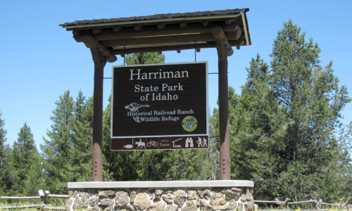
Beginning in Wallowa Lake, Oregon, the Nez Perce Trail moves northeast, crossing the Snake River and entering Idaho at Lewiston. Cutting across north-central Idaho, the trail enters Montana near Lolo Pass, travels through the Bitterroot Valley, and re-enters Idaho. Going eastward at this point, it goes back into Montana and crosses the Continental Divide. It travels through Yellowstone National Park and follows the path of the Clark Fork River. It moves north and ends 40 miles from the Canadian border.
Seasons
The Nez Perce Trail is accessible all year, but the best time for hiking or sightseeing is in the spring, summer and fall.
Activities
When the Nez Perce came into Yellowstone National Park, they came upon some of the early tourists and prospectors. They were only within the park for two weeks before leaving and following the Shoshone River and moving up the Clark’s Fork Canyon. You can experience what they saw along the Nez Perce Trail.
Hiking
As you move through Yellowstone Park, you will pass a number of hot springs and thermal attractions. You will follow the Mary Mountain Trail and cross Nez Perce Creek. This four-mile two-hour hike is an easy to moderate trek that gives you the feel of what it must have been like for these peaceful Indians.
Horseback Riding and Pack Trips
The wilderness that the Nez Perce traversed with about 750 men, women, and children and around 3,000 horses remains now much as it was at the time of their flight. You can ride the trail through mountain meadows and along pristine streams. Take a one-day ride or a five-day trip. Experience the Nez Perce Trail and see the wildlife in Lamar River Valley. You can even stop and fish.
Scenic Driving
The Nez Perce National Historic Trail Auto Route retraces the route of Chief Joseph and his band of Nez Perce Indians as they moved towards Canada in 1877. More than 1,500 miles of roads have been designated to roughly follow this path. Trail signs have been erected along the primary route as well as two alternate segments. You can get some auto tour guides in the form of pamphlets, including maps, at https://www.fs.usda.gov/npnht/
Sightseeing
Pay your tribute to the Nez Perce by visiting Camas Meadows, only 22 miles west of Dubois on Highway 22. View and take pictures of the metal silhouettes of three Nez Perce Warriors on horseback.
Additional Info
Beginning in 1860, Nez Perce lands were overrun with gold miners, merchants and settlers. Their lands were appropriated and their livestock stolen. The Nez Perce refused to sign a treaty, giving their lands to the government. Conflicts developed, making life for the Indians difficult.
In the summer of 1877, Chief Joseph’s band of Nez Perce Indians were ordered to turn over their land and move to a reservation. Pursued by the United States Army, this band began their epic flight to Canada to escape and get peace. The path they took is now called the Nez Perce Trail.
They were finally trapped just short of the Canadian border and surrendered to the Army who sent them to exile in Oklahoma.
- The Nez Perce Trail extends 1,170 miles from Oregon to Montana
- This trail retraces the route of the Nez Perce Indians as they attempted to get to Canada and freedom
- Hike the Mary Mountain Trail and cross Nez Perce Creek
- Horseback ride along the Nez Perce Trail